The Transportation Benefits of Danyang-Kunshan Grand Bridge in China

Image


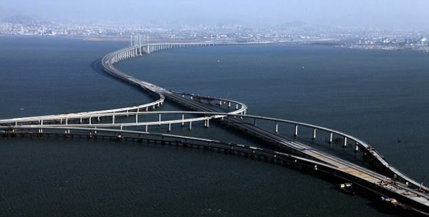
            Danyang–Kunshan is the world longest bridge completed in 2010 and opened after a year. The bridge is located in Jiangsu province and is essentially along the rail-road between Nanjing and Shanghai. Accordingly, the bridge is built corresponding to the Yangtze River and passes through Danyang via Wuxi to Kunshan. The bridge guzzled $8.5 billion, employed 10,000 workers and completed within 4 years. Danyang-Kunshan Bridge is 165 km long and among the marvels of architecture. Certainly, among actual benefit of Danyang-Kunshan Bridge is to facilitate the Beijing high-speed railway system. Chinese travelers and businessmen benefit from this bridge, since it provide vital transportation tool. The bridge also serves as the main highway across the Hangzhou Bay. The travel time from Ningbo to Jiaxing is by over a half since it was 4.5 hours and has reduced to only 2 hours. The bridge is also the current tourist destination and this has generated tremendous revenue, as it also holds the current Guinness World Record. Halfway, when going along the bridge, there is a conference center, a gas station, a hotel and recreational facilities entailing a lookout tower attracting tourists. Indeed, within few decades, China has 11 of the 15 longest bridges in the world. This also shows the aggressive nature and consistencies the communist nation has taken to venture massive architectural marvels that lure other under-developed countries to seek assistance from China. Undeniably, the Danyang-Kunshan Bridge is self-demonstration meant to capture attention of the rest of the globe by concisely ascertaining that there is an emerging superpower in waiting. Succinctly, China has taken almost major construction projects in the African continent including oil exploration and space expeditions. In a nutshell, these are a few of the Chinese ventures that essentially are working to their advantage in the struggle for the world superiority (Pickup 1).

Work cites

Pickup, Oliver. A Bridge Too Far? China Unveils World’s Longest Sea Bridge which is Five         Miles Longer than the Dover-Calais Crossing. Mail Online, January 2011.

<http://www.dailymail.co.uk/news/article-1343004/A-bridge-far-China-unveils-worlds-     longest-sea-bridge-miles-FURTHER-Dover-Calais-crossing.html>
Standard

Transportation System of Tokyo Japan

Image


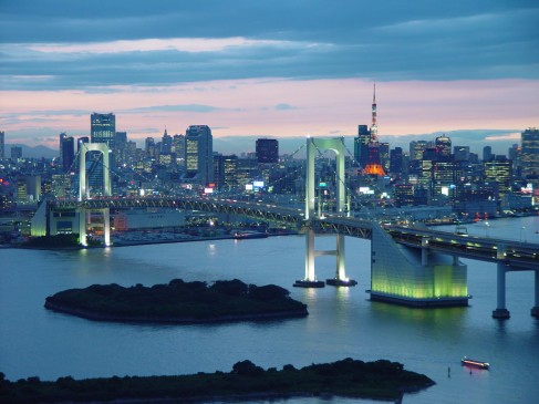
Tokyo Japan is among the major cities in the world that bustles with massive transportation infrastructure. The rail transport system is the main mode of commuting and has been legendry, since some subways were built in 1927. Indeed, Tokyo is touted to have the most widespread metropolitan railway registering 40 million passengers daily. There are over 880 unified rail stations and 282 Subways in the Tokyo Metropolis. Despite this immensity, expansion is continuous where there are upgrades and few new systems. The government owns some of the companies running the rail metro systems, while many are owned my individual firms. Definitely, during peak hours, these trains are extremely crowded that some people are pushed into trains by contracted pushers (Kato, Yuichiro and Masashi 777-778). Buses and trams in Tokyo are believed to serving secondary purposes after the railways, and are mainly feeding from rail stations and subways. Undeniably, there are also long distance buses that mainly ply routes that are not properly covered by the metro system or passengers will luggage though, they are few. Taxis are also present in Tokyo serving as buses, but are mainly used during later hours when the trains are not in use. Business individuals that need to move around the city use taxis to avoid difficulties in accessing certain parts at will. Passenger ferries are also functioning between Tokyo, Yokosuka, Yokohama among others.  One of the prominent ferry services is Tokyo-Wan Ferry. There are also other cruise ships between Hokkaido and Okinawa Island. Private boats are also available plying between Tokyo and other Japanese Islands. In Tokyo, there is a Tokyo Haneda and Narita airport serving as international arrivals and commercial functions. There are also other connecting airports like Shizuoka and Sapporo, which are more popular for their low-cost services. Helicopter services are also available in other places especially in Narita linking parts of Tokyo (Japan-guide.com1).


Work cites

Japan-guide.com “Transportation” 19 Oct. 2013.Web.

            <http://www.japan-guide.com/e/e627.html&gt;

Kato, Hironori, Yuichiro Kaneko, and Masashi Inoue. “Comparative Analysis of Transit    Assignment: Evidence from Urban Railway System in the Tokyo Metropolitan Area.”        Transportation 37.5 (2010): 775-99. ProQuest. Web. 19 Oct. 2013.

Standard

Dubai’s Train Transport

dubai-090909

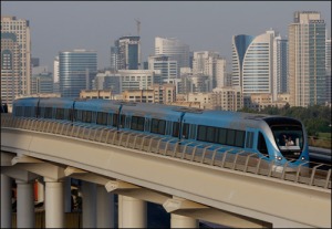
            In the year 1997, the municipality of Dubai saw a great need for a modern railway system to ease congestion on the major roads and mitigate pressures on the existing infrastructure. The groundwork engineering contract was awarded to Systra and the Dubai Rail Link (DURL), which entails four major companies led by Japan’s Mitsubishi. The initial scheme was to build two lines of high-tech driverless swift transport composition. In September 2009, the municipality inaugurated the first urban metro network in the Gulf’s Arab States. Certainly, the intended purpose was met, since the system alleviated the daily strain of road commuters who were mainly workers in the emirates. According to facts release by the authorities, over 1.7 million people were recorded to have used the metro system in its first month of functioning. The Red Line section was the first to be completed by April 2010, and the average travelers on this segment alone surpass 180,000 passengers on a daily basis. The Green Line which started became operational in September 2011, has recorded passenger usage of up to 100, 000 people daily. Aggressive property development, financial services, air transport and tourism Dubai has a rapid growing population which is expected to trigger heavy traffic congestion. It is estimated that by 2017, the population will reach the three million mark as the increase has been consistent citing the annual rise of 6.4%. In view of these facts, when the metro system will be fully operational, approximately 1.2 million passengers or about 355 million people will use the system each day. Consequently, the DURL is also negotiating with multi-international firms to acquire brand-rights and advertisements in view of increasing the metro revenues. In the world stage, the Dubai metro spans at 74.69 km and as the longest driverless system which by 2012, was entered in the Guinness World Records. Evidently, the massive work carried out on the metro system is spectacular, since the metro tracks at no point cross highways, though there are feeder services for the buses and taxis to ease inconveniences at some points. There are also underground constructions that never affected the existing buildings. There also exists elevated train viaducts designed to augment the urban structural designs along the course (Khaleej Times1).


Work cites

Khaleej Times. Dubai in Guinness for Longest Driverless Metro 22 Feb. 2006. Web. 19     Oct.2013.

<http://www.khaleejtimes.com/DisplayArticle08.asp?xfile=data/theuae/2012/February/th            euae_February611.xml&section=theuae>


Standard

The Transportation System of Singapore


         1_Singapore_skyline

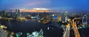
Transportation system in Singapore is generally Land-based. Various regions of Singapore are reachable by road connecting the islands such as Jurong and Sentosa. Singapore has also exceptional road link to the neighboring state of Malaysia. There are definitely major challenges facing Singapore’s road transport especially the growing urban population and limited space. Compared to other world major cities, Singapore also experiences heavy traffic mainly on major roads and this has necessitated the government to impose certain ways to minimize the influx of vehicles in the streets, since buses and cars are the major road users. There is also the cable car transport system that operates between the mainland, Sentosa Island and Mount Faber. Since its recent refurbishment in 2010, the Cable car system is seen as a fine option of accessing other regions in Singapore in quick-time especially by tourists. Singapore also thrives with a standard rail gauge system that aids railway transport. The city has about four major functioning rail systems that are managed by private companies like, SBS Transit, Circle Line and others. The rail network link is estimated to be over 95 miles hosting around 102 stations. Accordingly, some are still under construction and intensive planning. There also exists Light Rail Transit (LRT) structure comprising of 14 stations, which originally introduced in Bukit Panjang in 1999 with the length of 7.8kms. Another (LRT) line was also commissioned in 2003 and 2005 in Sengkang and Punggol respectively, serving the residences. Hitachi Asia Company also built 2.1 km Sentosa monorail 2007 to assist in the rail transport. Boats and ferry transport to the surrounding islands are available at Changi and other major terminal like Tanah Merah. Cruise ships are also available more so, to visitors that are visiting the country. Undeniably, Singapore boasts as the busiest and best seaport in Asia, outshining Shanghai and Hong Kong.

Air transport is also a thriving business in Singapore as it is known for famous tourist attractions. Changi airport is among the vital air hubs in the region. Seletar airport is also a great hub though, is mainly used for private aviation linking Redang and Tioman Islands (Getting Around 2013)


Work cites

Singapore. Getting Around. 19 Oct. 2013.Web         <http://www.lonelyplanet.com/singapore/transport/getting-            around#238228>

Standard

Transportation system in San Francisco CA, USA

san-francisco

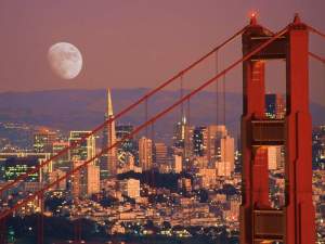
The transportation system of San Francisco city is unique and has vast provisions that can be compared to very few cities in the US or perhaps around the globe. Accordingly, as any other major city in the world would offer, San Francisco presents numerous transportation modes that should be used according to needs and locations at any given time. Moving around by car in San Francisco is fun and presents opportunities of viewing the vast city in various corners and regions using tall interchanging roads and ramps. The main challenge is the heavy traffic that is touted as among the nightmares of the city due to its legendry car culture. Since their inception in 1873, cable cars acting as mobile landmarks, have reigned in the city throughout the year. The cable car lines are mostly popular with tourists since they offer vast panoramic views by the three main cable line companies. Undeniably, the natives also enjoy rides in these cable cars around the city. Streetcars using light rails network in the city are also exceptional in getting any individual around the city. Like the cable cars, these Metro lines or also historic to San Francisco. Conversely, they are known to be less crowded during early morning and late evening hours. There are also buses and trolley buses that move around the city in almost every minute.

Caltrains also offer standard train services between San Jose to San Francisco and, the Peninsula. There are also ferry services operating between Sausalito and Alcatraz. Further ferries are accessible to Oakland, Angel Island, Alameda and other places within the pacific waters. Indeed San Francisco has also major airports that serve both domestically and internationally. Los Angeles and San Francisco airports are considered among the busiest airports in the US, due to their panoramic locations and major tourist attraction across the region (Getting Around 2013).


Works Cited

California. Getting Around.19 Oct. 2013.Web

            <http://www.visitcalifornia.com/Travel-Tools/Getting-Around/&gt;

Standard

Train Transportation In Malaysia


8075666648_c049268971_ztransforming-transportation-in-malaysia


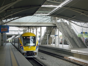
The train network in Malaysia can be split into two types of service the inter city, countrywide, traditional KTMB rail network and the inner city, light rail transit networks. While the KTMB service serves the entire country, travelling between major cities and also up into Thailand, trains can be old, slow and, ultimately, an uncomfortable way to travel the breadth of the country.

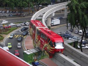
Nevertheless, the service is well priced and some locals favour this method over the road transit alternatives. In contrast, KL’s LRT, Monorail and hopefully Penang’s planned rail services are fast, clean, cheap and very well used. Providing you are close to a station, they are perhaps the best way to commute around the city.

The Putra LRT network, run by RapidKL, serves 48 stations across the Klang Valley. Even the longest single journey will cost less than RM3 and travellers can use prepaid Touch ‘n Go cards to pay the fare. Alternatively, daily travel cards can be bought for RM7 and allow travel throughout the Klang Valley on all RapidKL affiliated services (including buses and trains).

Also in the Klang Valley, the KLIA Express has been a fantastic success, transporting travellers to and fro KL city center and the Kuala Lumpur International Airport. The journey costs just RM35 for one way (RM15 for children) and takes 28minutes from station to station (KL Central–KLIA–KL Central). Malaysia Airlines also have a check-in counter at KL Central allowing travellers to check in for their flight before even arriving at the airport.


References:

http://en.wikipedia.org/wiki/Transport_in_Malaysia

http://www.khaosanroad.com/index.php/ja/malaysia/557-types-of-transport-in-malaysia

http://www.myworklife.my/lifestyle/live/transportation/public-transport-in-malaysia/

Standard

Definitions of Engineering, Civil engineering, andTransportation Engineering

Image


What is engineering?

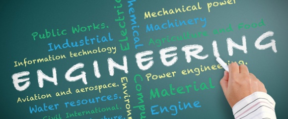
Engineering is the practical application of science and math to solve problems, and it is everywhere in the world around you. From the start to the end of each day, engineering technologies improve the ways that we communicate, work, travel, stay healthy, and entertain ourselves.

Image

What is civil engineering?

Civil engineering is the design and maintenance of public works such as roads, bridges, water and energy systems as well as public facilities like ports, railways and airports. Civil engineers touch many aspects of our everyday lives. From the water you use to brush your teeth in the morning to the road you drive on to work and the school where you take your children to the power that charges your cell phone.

Image

What is transportation engineering?

Transportation engineers are aimed and involved with the safe and efficient movement of both people and goods. They design and maintain all types of transportation facilities, including Highways and streets, Mass transit systems, Railroads, Airfields, and Ports and harbors


Sources:

http://www.ece.gatech.edu/academics/outreach/engineering.html

http://www.asce.org/What-Is-Civil-Engineering-/

https://www.civil.tamu.edu/areas/transportation/

Standard